Forest Solutions
Confidence Experience Knowledge
Aiding Recovery, Assisting Restoration, and Building Resilience for Australia's Temperate Forests
Aerial Services |
  
|
 Forests in Australia are expansive, covering thousands of hectares. For example in Victoria alone forests cover over 8 million ha, much of it in mountainous country. Even if you are part of an organisation which managers only a small portion of this, the geographic expanse and variability of forests pose serious challenges. At Forest Solutions we have overcome many of these challenges based on long experience - you can best assess, observe, measure, map and photograph large areas of forest from an aerial platform. Utilising either jet-propelled helicopters or fixed-wing light aircraft, we can configure for your needs. And the costs of running your organisation is a major consideration, such that helicopters would only be used if necessary. We also specialise in adapting the use of lower cost fixed-wing aircraft to your needs.
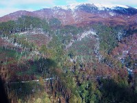
Forest Solutions currently conducts over 100 flight-hours on average per year across various projects, depending on demand. We currently use aerial capacity to assess eucalypt flowering and map its extent, undertake scorch assessments following bushfires, assess the extent of dieback due to BMAD, PC or other agents, capture high resolution oblique images of various forest operations such as burning outcomes and wind damage assessments, and undertake mid-altitude vertical aerial photography (10,000 feet) to undertake detailed API point assessments for vegetation damage, forest health monitoring and stocking. Staff also have experience with fire spotting and aerial habitat assessment for biodiversity outcomes.
Many tasks you ordinarily undertake on foot, over long periods, with high OH&S risk and high costs can be undertaken from the air in a small fraction of the time.
Our aerial skills can be adapted to plantation management as well.
At Forest Solutions we can manage large aerial projects, such as seeding or aerial spraying operations undertaken by helicopter, and have preferred, accredited providers standing by. Improvisation to overcome technical challenges is second nature and we are happy to provide examples of such work. Our scientific knowledge, specialising in forest Silviculture and ecology, enables a level of fine tuning not present with other general aviation organisations.
Our Chief consulting Pilot for light aircraft, Ron Walpole is ex RAAF with a career's experience in remote and mountain flying. His technical capability, linked with our capacity for navigation and observation has produced an experienced team. Call us and speak about your needs - remember, increasing your confidence when decision making is our focus and we can provide the aerial capacity to support your objectives.
See more images related to aerial services
